
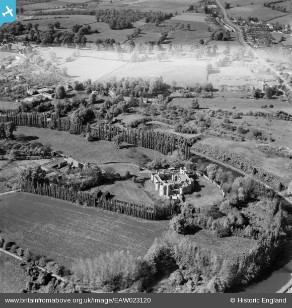
EAW023120 ENGLAND (1949). Allington Castle, Allington, 1949
© Copyright OpenStreetMap contributors and licensed by the OpenStreetMap Foundation. 2026. Cartography is licensed as CC BY-SA.
Nearby Images (18)
EAW023120

EAW023155

EAW023156

EAW023158

EAW048699

EAW023157

EAW048697

EAW023119

EPW009213

EAW005193

EPW005633

EPW009214

EAW048700

EPW026070

EAW048698

EPW005594

EAW002349

EAW002348

Details
| Title | [EAW023120] Allington Castle, Allington, 1949 |
| Reference | EAW023120 |
| Date | 10-May-1949 |
| Link | |
| Place name | ALLINGTON |
| Parish | |
| District | |
| Country | ENGLAND |
| Easting / Northing | 575165, 158041 |
| Longitude / Latitude | 0.51263529908753, 51.294008472386 |
| National Grid Reference | TQ752580 |
Pins

I in the sky |
Sunday 21st of November 2021 11:59:17 PM | |

Matt Aldred edob.mattaldred.com |
Tuesday 9th of March 2021 02:05:47 PM | |
|
jrussill |
Thursday 11th of December 2014 07:14:12 PM |
User Comment Contributions
WW2 Pillbox |
jrussill |
Thursday 11th of December 2014 07:15:41 PM |