
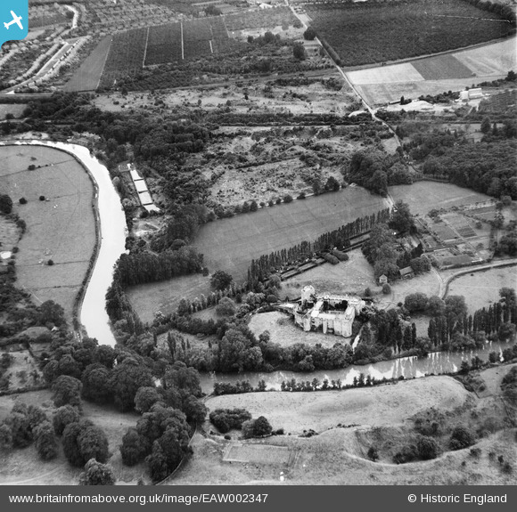
EAW002347 ENGLAND (1946). Allington Castle and environs, Allington, 1946
© Copyright OpenStreetMap contributors and licensed by the OpenStreetMap Foundation. 2026. Cartography is licensed as CC BY-SA.
Nearby Images (18)
EAW002347

EAW002348

EAW002349

EPW005594

EPW026070

EPW005633

EAW048698

EAW048697

EPW009213

EPW009214

EAW048700

EAW023119

EAW005193

EAW048699

EAW023158

EAW023155

EAW023156

EAW023157

Details
| Title | [EAW002347] Allington Castle and environs, Allington, 1946 |
| Reference | EAW002347 |
| Date | 5-September-1946 |
| Link | |
| Place name | ALLINGTON |
| Parish | |
| District | |
| Country | ENGLAND |
| Easting / Northing | 575122, 157781 |
| Longitude / Latitude | 0.51189158382752, 51.291685814238 |
| National Grid Reference | TQ751578 |
Pins

I in the sky |
Sunday 21st of November 2021 11:48:53 PM | |

Matt Aldred edob.mattaldred.com |
Friday 5th of March 2021 10:04:34 PM | |

Sparky |
Sunday 17th of September 2017 04:21:19 PM | |
|
Sparky |
Sunday 17th of September 2017 04:20:27 PM | |
|
Sparky |
Sunday 17th of September 2017 04:19:46 PM | |
|
cptpies |
Friday 15th of April 2016 01:28:44 PM | |
|
jrussill |
Thursday 11th of December 2014 07:17:14 PM |
User Comment Contributions

WW2 Pillbox |
jrussill |
Thursday 11th of December 2014 07:18:22 PM |