
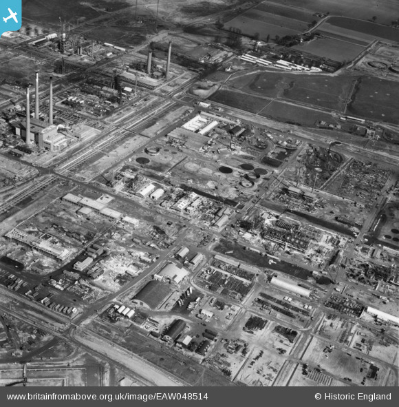
EAW048514 ENGLAND (1953). The Anglo-Iranian Oil Co Ltd Kent Oil Refinery under construction, Isle of Grain, 1953
© Copyright OpenStreetMap contributors and licensed by the OpenStreetMap Foundation. 2026. Cartography is licensed as CC BY-SA.
Nearby Images (20)
EAW048514

EAW048519

EAW045770

EAW048517

EAW045763

EAW034852

EAW034851

EAW045769

EAW048513

EAW048563

EAW048518

EAW048566

EAW045771

EAW039859

EAW048527

EAW045780

EAW039858

EAW048525

EAW048562

EAW048561

Details
| Title | [EAW048514] The Anglo-Iranian Oil Co Ltd Kent Oil Refinery under construction, Isle of Grain, 1953 |
| Reference | EAW048514 |
| Date | 27-March-1953 |
| Link | |
| Place name | ISLE OF GRAIN |
| Parish | ISLE OF GRAIN |
| District | |
| Country | ENGLAND |
| Easting / Northing | 587251, 175027 |
| Longitude / Latitude | 0.69475084594287, 51.44274391417 |
| National Grid Reference | TQ873750 |
Pins
Be the first to add a comment to this image!