
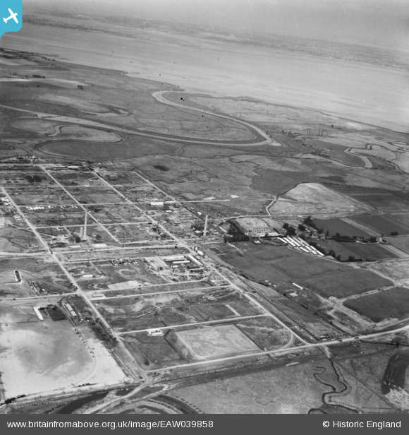
EAW039858 ENGLAND (1951). The Anglo-Iranian Oil Co oil refinery under construction, Isle of Grain, from the south-east, 1951
© Copyright OpenStreetMap contributors and licensed by the OpenStreetMap Foundation. 2026. Cartography is licensed as CC BY-SA.
Nearby Images (5)
EAW039858

EAW034853

EAW048517

EAW039859

EAW048514

Details
| Title | [EAW039858] The Anglo-Iranian Oil Co oil refinery under construction, Isle of Grain, from the south-east, 1951 |
| Reference | EAW039858 |
| Date | 20-August-1951 |
| Link | |
| Place name | ISLE OF GRAIN |
| Parish | ISLE OF GRAIN |
| District | |
| Country | ENGLAND |
| Easting / Northing | 587499, 175121 |
| Longitude / Latitude | 0.69836538858539, 51.443506233647 |
| National Grid Reference | TQ875751 |
Pins

redmist |
Monday 24th of January 2022 10:55:47 PM | |
|
redmist |
Monday 24th of January 2022 10:52:58 PM | |
|
redmist |
Monday 24th of January 2022 10:45:23 PM | |
|
redmist |
Monday 24th of January 2022 10:44:03 PM |