
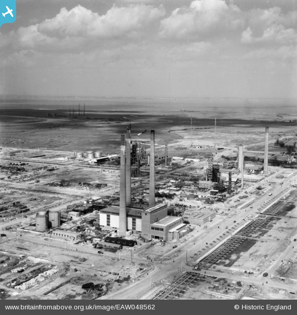
EAW048562 ENGLAND (1953). The Anglo-Iranian Oil Co Ltd Kent Oil Refinery under construction, Isle of Grain, from the south, 1953
© Copyright OpenStreetMap contributors and licensed by the OpenStreetMap Foundation. 2026. Cartography is licensed as CC BY-SA.
Nearby Images (24)
EAW048562

EAW048525

EAW048561

EAW045780

EAW048566

EAW048563

EAW048518

EAW045768

EAW045764

EAW048522

EAW045771

EAW048516

EAW048513

EAW034851

EAW034852

EAW048527

EAW048519

EAW048564

EAW045763

EAW048514

EAW045770

EAW045767

EAW045753

EAW045772

Details
| Title | [EAW048562] The Anglo-Iranian Oil Co Ltd Kent Oil Refinery under construction, Isle of Grain, from the south, 1953 |
| Reference | EAW048562 |
| Date | 31-March-1953 |
| Link | |
| Place name | ISLE OF GRAIN |
| Parish | ISLE OF GRAIN |
| District | |
| Country | ENGLAND |
| Easting / Northing | 587040, 175205 |
| Longitude / Latitude | 0.69181199323244, 51.444412548118 |
| National Grid Reference | TQ870752 |
