
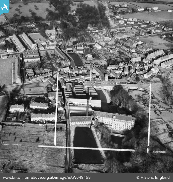
EAW048459 ENGLAND (1953). Woodlands Mill, Bobbin Mill and the village, Steeton, 1953. This image was marked by Aerofilms Ltd for photo editing.
© Copyright OpenStreetMap contributors and licensed by the OpenStreetMap Foundation. 2025. Cartography is licensed as CC BY-SA.
Nearby Images (11)
EAW048459

EAW048464

EAW048464
EAW048460

EAW048462

EAW048461

EAW048465

EAW048466

EAW048468

EAW048463

EAW048467

Details
| Title | [EAW048459] Woodlands Mill, Bobbin Mill and the village, Steeton, 1953. This image was marked by Aerofilms Ltd for photo editing. |
| Reference | EAW048459 |
| Date | 24-February-1953 |
| Link | |
| Place name | STEETON |
| Parish | STEETON WITH EASTBURN |
| District | |
| Country | ENGLAND |
| Easting / Northing | 403317, 444219 |
| Longitude / Latitude | -1.9495204041662, 53.893933369748 |
| National Grid Reference | SE033442 |
Pins

redmist |
Sunday 21st of November 2021 10:08:58 AM | |
|
redmist |
Sunday 21st of November 2021 10:03:13 AM | |
|
redmist |
Sunday 21st of November 2021 09:59:30 AM | |
|
redmist |
Thursday 18th of November 2021 05:05:10 PM |