
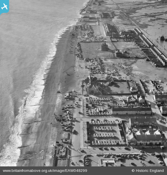
EAW048299 ENGLAND (1953). Storm damage along the front between Station Road and the Manor House Hotel, Felixstowe, 1953
© Copyright OpenStreetMap contributors and licensed by the OpenStreetMap Foundation. 2026. Cartography is licensed as CC BY-SA.
Nearby Images (5)
EAW048299

EAW048294

EPW039285

EAW048298

EAW024309

Details
| Title | [EAW048299] Storm damage along the front between Station Road and the Manor House Hotel, Felixstowe, 1953 |
| Reference | EAW048299 |
| Date | 2-February-1953 |
| Link | |
| Place name | FELIXSTOWE |
| Parish | FELIXSTOWE |
| District | |
| Country | ENGLAND |
| Easting / Northing | 629403, 233225 |
| Longitude / Latitude | 1.3386385682855, 51.949694926694 |
| National Grid Reference | TM294332 |
Pins

redmist |
Friday 31st of January 2025 08:52:12 PM | |
|
redmist |
Friday 31st of January 2025 08:51:03 PM | |
|
redmist |
Friday 31st of January 2025 08:49:40 PM | |
|
redmist |
Friday 31st of January 2025 08:48:38 PM | |
|
redmist |
Friday 31st of January 2025 08:47:40 PM | |
|
Al |
Saturday 26th of November 2016 01:43:26 AM |