
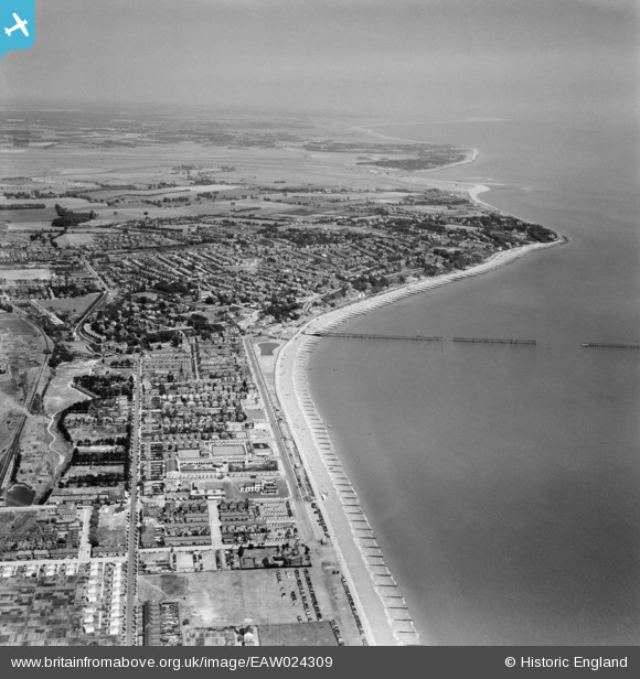
EAW024309 ENGLAND (1949). The town, Felixstowe, from the south-west, 1949
© Copyright OpenStreetMap contributors and licensed by the OpenStreetMap Foundation. 2026. Cartography is licensed as CC BY-SA.
Nearby Images (5)
EAW024309

EPW039285

EPW002005

EAW024307

EAW048299

Details
| Title | [EAW024309] The town, Felixstowe, from the south-west, 1949 |
| Reference | EAW024309 |
| Date | 4-July-1949 |
| Link | |
| Place name | FELIXSTOWE |
| Parish | FELIXSTOWE |
| District | |
| Country | ENGLAND |
| Easting / Northing | 629595, 233461 |
| Longitude / Latitude | 1.3415853594828, 51.951734176615 |
| National Grid Reference | TM296335 |
Pins

redmist |
Wednesday 10th of December 2025 08:27:47 PM | |
|
Graham Yaxley |
Thursday 6th of August 2015 04:50:46 PM |