
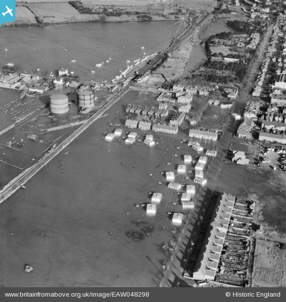
EAW048298 ENGLAND (1953). Flooding around Langer Road, Felixstowe, 1953
© Copyright OpenStreetMap contributors and licensed by the OpenStreetMap Foundation. 2026. Cartography is licensed as CC BY-SA.
Nearby Images (5)
EAW048298

EAW048294

EAW048290

EAW048299

EAW024307

Details
| Title | [EAW048298] Flooding around Langer Road, Felixstowe, 1953 |
| Reference | EAW048298 |
| Date | 2-February-1953 |
| Link | |
| Place name | FELIXSTOWE |
| Parish | FELIXSTOWE |
| District | |
| Country | ENGLAND |
| Easting / Northing | 629173, 233351 |
| Longitude / Latitude | 1.3353813759588, 51.950920771496 |
| National Grid Reference | TM292334 |
