
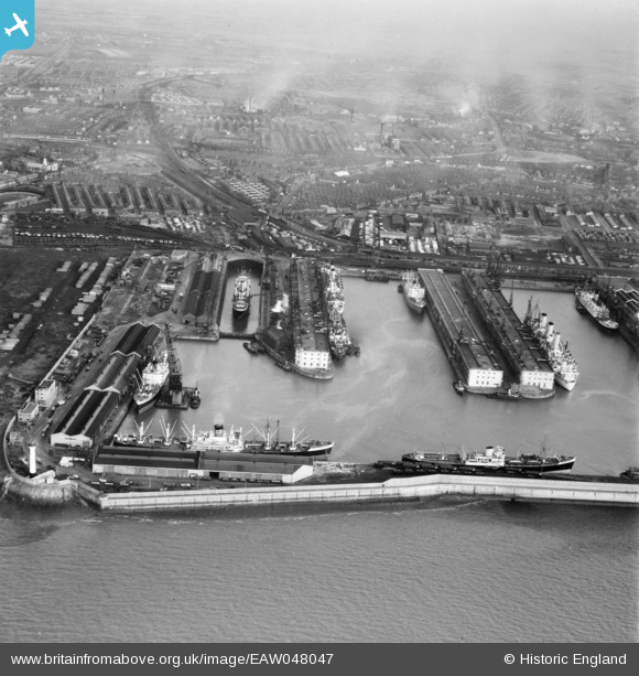
EAW048047 ENGLAND (1952). Gladstone Dock, Bootle, from the south-west, 1952
© Copyright OpenStreetMap contributors and licensed by the OpenStreetMap Foundation. 2026. Cartography is licensed as CC BY-SA.
Nearby Images (7)
EAW048047

EAW048044

EAW004630

EPW037727

EAW001711

EAW004632

EAW004633

Details
| Title | [EAW048047] Gladstone Dock, Bootle, from the south-west, 1952 |
| Reference | EAW048047 |
| Date | 12-December-1952 |
| Link | |
| Place name | BOOTLE |
| Parish | |
| District | |
| Country | ENGLAND |
| Easting / Northing | 332218, 395856 |
| Longitude / Latitude | -3.0208815078465, 53.454838177392 |
| National Grid Reference | SJ322959 |
Pins

redmist |
Friday 12th of February 2021 07:58:38 PM | |
|
redmist |
Friday 12th of February 2021 07:58:04 PM | |
|
Kevin O'Hare |
Friday 21st of February 2020 12:31:31 AM | |
|
Lord Axminister |
Sunday 8th of June 2014 11:11:35 PM | |
|
Lord Axminister |
Sunday 8th of June 2014 11:09:50 PM |