
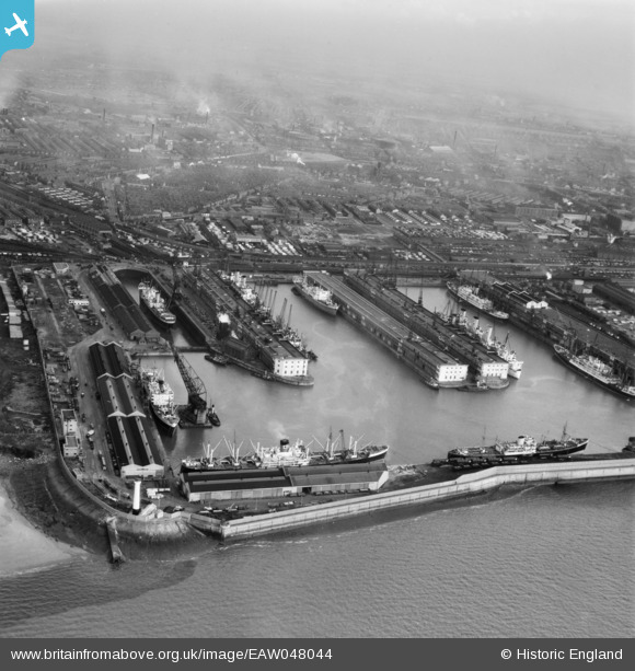
EAW048044 ENGLAND (1952). Gladstone Dock, Bootle, from the west, 1952
© Copyright OpenStreetMap contributors and licensed by the OpenStreetMap Foundation. 2026. Cartography is licensed as CC BY-SA.
Nearby Images (7)
EAW048044

EAW048047

EAW004630

EAW004632

EPW037727

EAW004633

EAW001711

Details
| Title | [EAW048044] Gladstone Dock, Bootle, from the west, 1952 |
| Reference | EAW048044 |
| Date | 12-December-1952 |
| Link | |
| Place name | BOOTLE |
| Parish | |
| District | |
| Country | ENGLAND |
| Easting / Northing | 332225, 395921 |
| Longitude / Latitude | -3.0207901090003, 53.45542330466 |
| National Grid Reference | SJ322959 |
Pins

austin |
Monday 19th of July 2021 11:24:22 AM | |
|
redmist |
Friday 12th of February 2021 07:50:44 PM | |
|
redmist |
Friday 12th of February 2021 07:49:50 PM | |
|
Kevin O'Hare |
Friday 21st of February 2020 12:29:04 AM | |
|
John Wass |
Monday 11th of May 2015 11:46:55 AM | |
|
Ronnie |
Friday 16th of January 2015 08:41:26 AM | |
|
Ronnie |
Wednesday 8th of October 2014 07:28:41 AM | |
|
morris minor |
Sunday 5th of October 2014 05:47:58 PM | |
|
Lord Axminister |
Saturday 14th of June 2014 12:17:18 AM |