
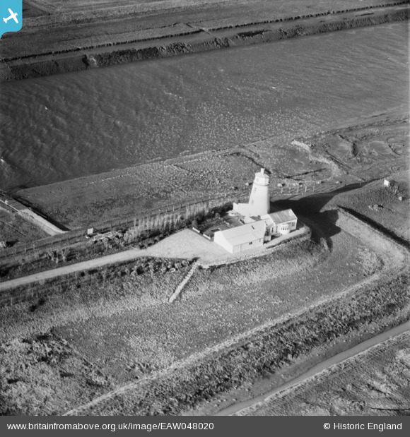
EAW048020 ENGLAND (1952). East Lighthouse (disused) alongside the River Nene, Guy's Head, 1952
© Copyright OpenStreetMap contributors and licensed by the OpenStreetMap Foundation. 2025. Cartography is licensed as CC BY-SA.
Nearby Images (7)
EAW048020
 alongside the River Nene, Guy's Head, 1952")
EAW048017A
 alongside the River Nene, Guy's Head, 1952")
EAW048018
 alongside the River Nene, Guy's Head, 1952. This image has been produced from a print.")
EAW048019
 alongside the River Nene, Guy's Head, 1952")
EAW048017
 alongside the River Nene, Guy's Head, 1952")
EAW048021
 alongside the River Nene, Guy's Head, 1952")
EAW048015
 alongside the River Nene, Guy's Head, 1952")
Details
| Title | [EAW048020] East Lighthouse (disused) alongside the River Nene, Guy's Head, 1952 |
| Reference | EAW048020 |
| Date | 2-December-1952 |
| Link | |
| Place name | GUY'S HEAD |
| Parish | SUTTON BRIDGE |
| District | |
| Country | ENGLAND |
| Easting / Northing | 549292, 325712 |
| Longitude / Latitude | 0.21511968328791, 52.807931826043 |
| National Grid Reference | TF493257 |
Pins
Be the first to add a comment to this image!