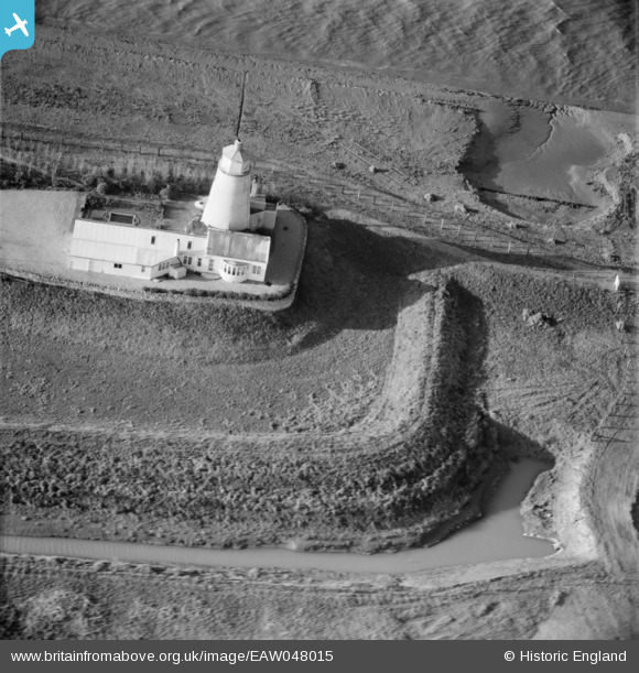
EAW048015 ENGLAND (1952). East Lighthouse (disused) alongside the River Nene, Guy's Head, 1952
© Copyright OpenStreetMap contributors and licensed by the OpenStreetMap Foundation. 2025. Cartography is licensed as CC BY-SA.
Nearby Images (7)
Details
| Title | [EAW048015] East Lighthouse (disused) alongside the River Nene, Guy's Head, 1952 |
| Reference | EAW048015 |
| Date | 2-December-1952 |
| Link | |
| Place name | GUY'S HEAD |
| Parish | SUTTON BRIDGE |
| District | |
| Country | ENGLAND |
| Easting / Northing | 549320, 325731 |
| Longitude / Latitude | 0.21554347589608, 52.808094766195 |
| National Grid Reference | TF493257 |
Pins
Be the first to add a comment to this image!


![[EAW048015] East Lighthouse (disused) alongside the River Nene, Guy's Head, 1952](http://britainfromabove.org.uk/sites/all/libraries/aerofilms-images/public/100x100/EAW/048/EAW048015.jpg)
![[EAW048017] East Lighthouse (disused) alongside the River Nene, Guy's Head, 1952](http://britainfromabove.org.uk/sites/all/libraries/aerofilms-images/public/100x100/EAW/048/EAW048017.jpg)
![[EAW048021] East Lighthouse (disused) alongside the River Nene, Guy's Head, 1952](http://britainfromabove.org.uk/sites/all/libraries/aerofilms-images/public/100x100/EAW/048/EAW048021.jpg)
![[EAW048018] East Lighthouse (disused) alongside the River Nene, Guy's Head, 1952. This image has been produced from a print.](http://britainfromabove.org.uk/sites/all/libraries/aerofilms-images/public/100x100/EAW/048/EAW048018.jpg)
![[EAW048017A] East Lighthouse (disused) alongside the River Nene, Guy's Head, 1952](http://britainfromabove.org.uk/sites/all/libraries/aerofilms-images/public/100x100/EAW/048/EAW048017A.jpg)
![[EAW048019] East Lighthouse (disused) alongside the River Nene, Guy's Head, 1952](http://britainfromabove.org.uk/sites/all/libraries/aerofilms-images/public/100x100/EAW/048/EAW048019.jpg)
![[EAW048020] East Lighthouse (disused) alongside the River Nene, Guy's Head, 1952](http://britainfromabove.org.uk/sites/all/libraries/aerofilms-images/public/100x100/EAW/048/EAW048020.jpg)