
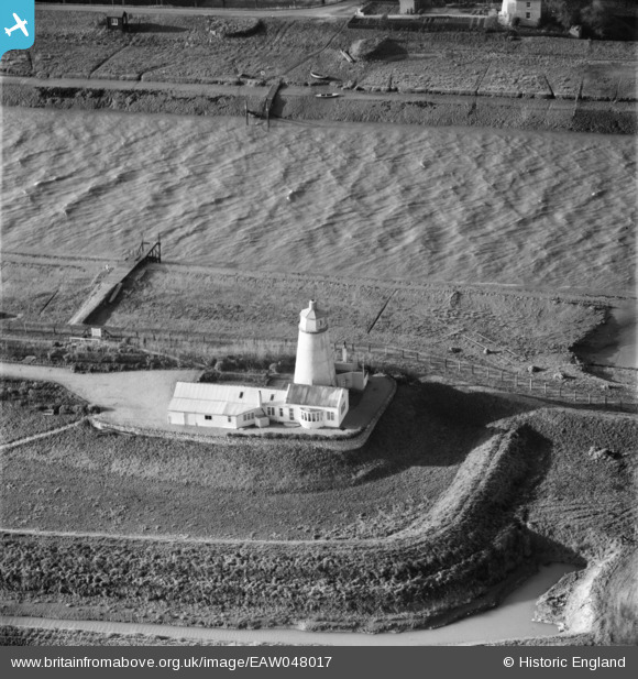
EAW048017 ENGLAND (1952). East Lighthouse (disused) alongside the River Nene, Guy's Head, 1952
© Copyright OpenStreetMap contributors and licensed by the OpenStreetMap Foundation. 2025. Cartography is licensed as CC BY-SA.
Nearby Images (7)
EAW048017
 alongside the River Nene, Guy's Head, 1952")
EAW048021
 alongside the River Nene, Guy's Head, 1952")
EAW048018
 alongside the River Nene, Guy's Head, 1952. This image has been produced from a print.")
EAW048017A
 alongside the River Nene, Guy's Head, 1952")
EAW048015
 alongside the River Nene, Guy's Head, 1952")
EAW048019
 alongside the River Nene, Guy's Head, 1952")
EAW048020
 alongside the River Nene, Guy's Head, 1952")
Details
| Title | [EAW048017] East Lighthouse (disused) alongside the River Nene, Guy's Head, 1952 |
| Reference | EAW048017 |
| Date | 2-December-1952 |
| Link | |
| Place name | GUY'S HEAD |
| Parish | SUTTON BRIDGE |
| District | |
| Country | ENGLAND |
| Easting / Northing | 549309, 325720 |
| Longitude / Latitude | 0.21537537018785, 52.807998990087 |
| National Grid Reference | TF493257 |
Pins
Be the first to add a comment to this image!
User Comment Contributions
This was the home of Sir Peter Scott at one time. I have seen a concrete mantle piece put in by Peter Scott with a flight of ducks etched into the concrete when still wet. |

Peter |
Wednesday 7th of January 2015 08:16:06 PM |