
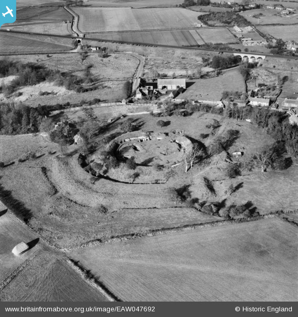
EAW047692 ENGLAND (1952). Basing House and the Tithe Barn at Grange Farm, Old Basing, 1952
© Copyright OpenStreetMap contributors and licensed by the OpenStreetMap Foundation. 2026. Cartography is licensed as CC BY-SA.
Nearby Images (8)
EAW047692

EAW004851

EAW004850

EAW004852

EAW047690

EAW047689

EAW047691

EAW004849

Details
| Title | [EAW047692] Basing House and the Tithe Barn at Grange Farm, Old Basing, 1952 |
| Reference | EAW047692 |
| Date | 7-November-1952 |
| Link | |
| Place name | OLD BASING |
| Parish | OLD BASING AND LYCHPIT |
| District | |
| Country | ENGLAND |
| Easting / Northing | 466249, 152586 |
| Longitude / Latitude | -1.050290386712, 51.268062100932 |
| National Grid Reference | SU662526 |
Pins

Matt Aldred edob.mattaldred.com |
Friday 11th of April 2025 06:52:27 PM | |

redmist |
Saturday 5th of December 2020 10:35:48 PM | |
|
redmist |
Saturday 5th of December 2020 10:34:23 PM | |
|
redmist |
Saturday 5th of December 2020 10:34:03 PM | |
|
redmist |
Saturday 5th of December 2020 10:33:43 PM | |
|
johnxyz |
Sunday 20th of July 2014 08:43:30 PM | |
|
johnxyz |
Sunday 20th of July 2014 08:41:37 PM | |
|
johnxyz |
Sunday 20th of July 2014 08:37:59 PM | |
|
johnxyz |
Sunday 20th of July 2014 08:37:20 PM |