
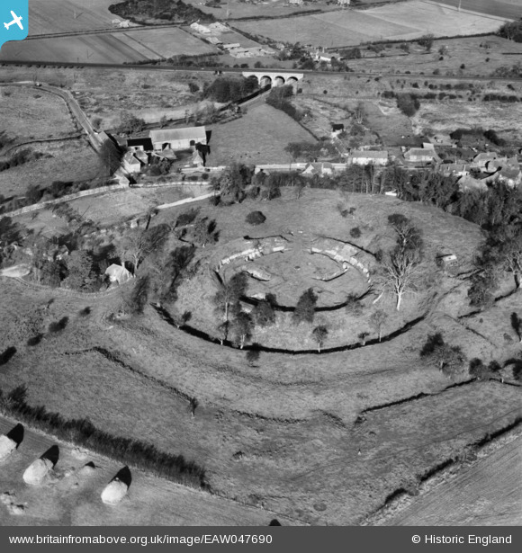
EAW047690 ENGLAND (1952). Basing House and the Tithe Barn at Grange Farm, Old Basing, 1952
© Copyright OpenStreetMap contributors and licensed by the OpenStreetMap Foundation. 2026. Cartography is licensed as CC BY-SA.
Nearby Images (8)
EAW047690

EAW004850

EAW004851

EAW047692

EAW047689

EAW004852

EAW047691

EAW004849

Details
| Title | [EAW047690] Basing House and the Tithe Barn at Grange Farm, Old Basing, 1952 |
| Reference | EAW047690 |
| Date | 7-November-1952 |
| Link | |
| Place name | OLD BASING |
| Parish | OLD BASING AND LYCHPIT |
| District | |
| Country | ENGLAND |
| Easting / Northing | 466234, 152599 |
| Longitude / Latitude | -1.0505029778332, 51.268180736019 |
| National Grid Reference | SU662526 |
Pins

redmist |
Saturday 5th of December 2020 10:40:07 PM | |
|
redmist |
Saturday 5th of December 2020 10:39:20 PM | |
|
redmist |
Saturday 5th of December 2020 10:38:58 PM | |
|
redmist |
Saturday 5th of December 2020 10:38:31 PM | |
|
johnxyz |
Sunday 20th of July 2014 08:51:46 PM | |
|
johnxyz |
Sunday 20th of July 2014 08:35:54 PM | |
|
johnxyz |
Sunday 20th of July 2014 08:33:55 PM | |
|
johnxyz |
Sunday 20th of July 2014 08:33:02 PM |