
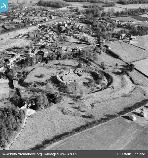
EAW047689 ENGLAND (1952). Basing House and the village, Old Basing, 1952
© Copyright OpenStreetMap contributors and licensed by the OpenStreetMap Foundation. 2026. Cartography is licensed as CC BY-SA.
Nearby Images (8)
EAW047689

EAW004852

EAW004850

EAW047692

EAW004851

EAW047690

EAW047691

EAW004849

Details
| Title | [EAW047689] Basing House and the village, Old Basing, 1952 |
| Reference | EAW047689 |
| Date | 7-November-1952 |
| Link | |
| Place name | OLD BASING |
| Parish | OLD BASING AND LYCHPIT |
| District | |
| Country | ENGLAND |
| Easting / Northing | 466259, 152604 |
| Longitude / Latitude | -1.050143716447, 51.268222787373 |
| National Grid Reference | SU663526 |
Pins

cptpies |
Thursday 3rd of February 2022 01:20:24 PM | |
|
Roberto |
Friday 15th of May 2015 11:12:07 AM | |
|
johnxyz |
Sunday 20th of July 2014 08:31:55 PM | |
|
johnxyz |
Sunday 20th of July 2014 08:26:41 PM | |
|
johnxyz |
Sunday 20th of July 2014 08:24:23 PM |