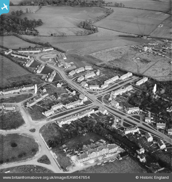
EAW047654 ENGLAND (1952). New housing surrounding Pickford Hill, Batford, 1952
© Copyright OpenStreetMap contributors and licensed by the OpenStreetMap Foundation. 2026. Cartography is licensed as CC BY-SA.
Nearby Images (9)
Details
| Title | [EAW047654] New housing surrounding Pickford Hill, Batford, 1952 |
| Reference | EAW047654 |
| Date | 27-October-1952 |
| Link | |
| Place name | BATFORD |
| Parish | HARPENDEN |
| District | |
| Country | ENGLAND |
| Easting / Northing | 514568, 215563 |
| Longitude / Latitude | -0.33734764083692, 51.826477465956 |
| National Grid Reference | TL146156 |
Pins

Walksleader |
Wednesday 27th of August 2014 08:49:19 PM |
User Comment Contributions
The remains of the Batford Prisoner of War camp is shown in the upper right corner. By this time (1952) it was being used as emergency accommodation for local people waiting for the Batford estate to be completed. Stan Ames |

Stan Ames |
Monday 25th of August 2014 07:27:58 PM |


![[EAW047654] New housing surrounding Pickford Hill, Batford, 1952](http://britainfromabove.org.uk/sites/all/libraries/aerofilms-images/public/100x100/EAW/047/EAW047654.jpg)
![[EAW047647] Batford County Primary School (Sauncey Wood Primary School) and new housing surrounding Pickford Hill, Batford, 1952](http://britainfromabove.org.uk/sites/all/libraries/aerofilms-images/public/100x100/EAW/047/EAW047647.jpg)
![[EAW047646] Batford County Primary School (Sauncey Wood Primary School) and new housing surrounding Pickford Hill, Batford, 1952](http://britainfromabove.org.uk/sites/all/libraries/aerofilms-images/public/100x100/EAW/047/EAW047646.jpg)
![[EAW047648] New housing surrounding Pickford Hill, Batford, 1952](http://britainfromabove.org.uk/sites/all/libraries/aerofilms-images/public/100x100/EAW/047/EAW047648.jpg)
![[EAW047655] New housing surrounding Porters Hill and Noke Shot, Batford, 1952](http://britainfromabove.org.uk/sites/all/libraries/aerofilms-images/public/100x100/EAW/047/EAW047655.jpg)
![[EAW047645] New housing surrounding Pickford Hill, Batford, 1952](http://britainfromabove.org.uk/sites/all/libraries/aerofilms-images/public/100x100/EAW/047/EAW047645.jpg)
![[EAW047656] New housing surrounding Porters Hill and Noke Shot, Batford, 1952](http://britainfromabove.org.uk/sites/all/libraries/aerofilms-images/public/100x100/EAW/047/EAW047656.jpg)
![[EPW005299] The Almagam Mills, Harpenden, 1921](http://britainfromabove.org.uk/sites/all/libraries/aerofilms-images/public/100x100/EPW/005/EPW005299.jpg)
![[EAW047657] New housing surrounding Noke Shot and Someries Road, Batford, 1952](http://britainfromabove.org.uk/sites/all/libraries/aerofilms-images/public/100x100/EAW/047/EAW047657.jpg)