
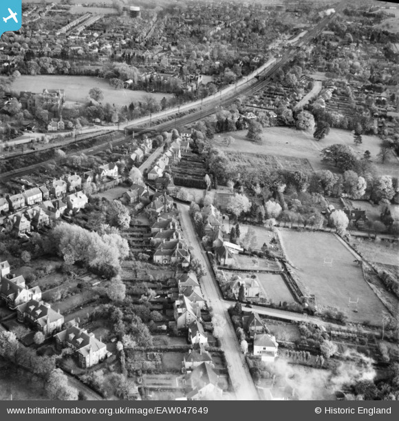
EAW047649 ENGLAND (1952). Wordsworth Road, Hardenwick School Playing Field and the surrounding area, Harpenden, 1952
© Copyright OpenStreetMap contributors and licensed by the OpenStreetMap Foundation. 2026. Cartography is licensed as CC BY-SA.
Nearby Images (7)
EAW047649

EAW047643

EAW047651

EAW047650

EAW047653

EPW007533

EAW047652

Details
| Title | [EAW047649] Wordsworth Road, Hardenwick School Playing Field and the surrounding area, Harpenden, 1952 |
| Reference | EAW047649 |
| Date | 27-October-1952 |
| Link | |
| Place name | HARPENDEN |
| Parish | HARPENDEN |
| District | |
| Country | ENGLAND |
| Easting / Northing | 513296, 214959 |
| Longitude / Latitude | -0.35599680021352, 51.821307976643 |
| National Grid Reference | TL133150 |
Pins

John W |
Sunday 5th of March 2017 08:00:44 PM | |
|
John Wass |
Tuesday 10th of February 2015 03:19:54 PM | |
On the Up fast, towards London |
John W |
Thursday 1st of September 2016 09:43:09 PM |
|
John Wass |
Tuesday 10th of February 2015 03:18:32 PM |