
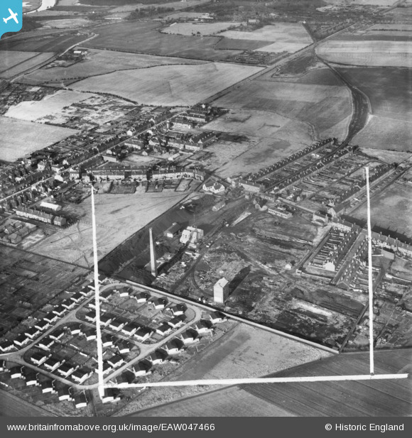
EAW047466 ENGLAND (1952). The Coal Briquette Works and environs, Hopetown, 1952. This image was marked by Aerofilms Ltd for photo editing.
© Copyright OpenStreetMap contributors and licensed by the OpenStreetMap Foundation. 2026. Cartography is licensed as CC BY-SA.
Nearby Images (10)
EAW047466

EAW047458

EAW047467

EAW047462

EAW047459

EAW047460

EAW047464

EAW047465

EAW047463

EAW047461

Details
| Title | [EAW047466] The Coal Briquette Works and environs, Hopetown, 1952. This image was marked by Aerofilms Ltd for photo editing. |
| Reference | EAW047466 |
| Date | 10-October-1952 |
| Link | |
| Place name | HOPETOWN |
| Parish | NORMANTON |
| District | |
| Country | ENGLAND |
| Easting / Northing | 439815, 423334 |
| Longitude / Latitude | -1.3967960098377, 53.704690038255 |
| National Grid Reference | SE398233 |
Pins

drj |
Monday 4th of January 2021 02:07:30 PM | |
|
Cairneymount |
Saturday 13th of June 2020 03:58:02 PM | |
|
dyey |
Thursday 1st of March 2018 08:54:44 PM | |
|
wookie |
Wednesday 26th of July 2017 04:22:13 PM | |
|
ncbnik |
Monday 25th of April 2016 06:02:26 PM | |
|
ncbnik |
Monday 25th of April 2016 06:01:10 PM | |
|
ncbnik |
Monday 25th of April 2016 05:56:28 PM | |
|
ncbnik |
Monday 25th of April 2016 05:52:40 PM |