
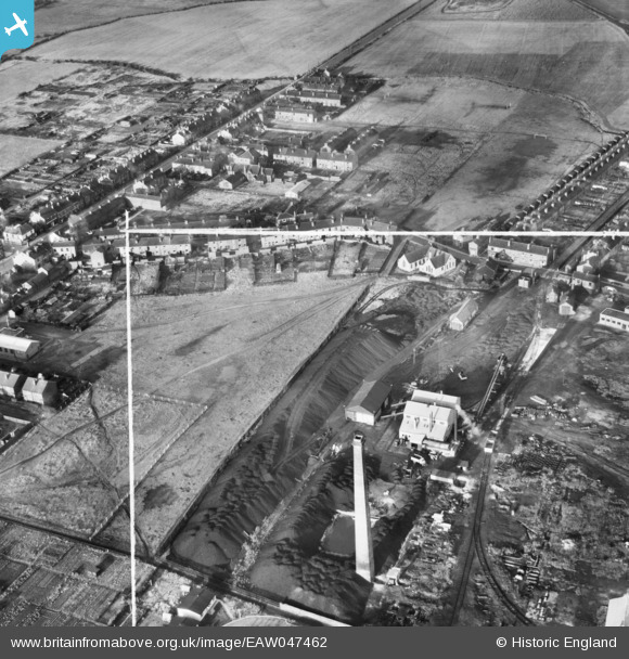
EAW047462 ENGLAND (1952). The Coal Briquette Works, Hopetown, 1952. This image was marked by Aerofilms Ltd for photo editing.
© Copyright OpenStreetMap contributors and licensed by the OpenStreetMap Foundation. 2026. Cartography is licensed as CC BY-SA.
Nearby Images (10)
EAW047462

EAW047466

EAW047458

EAW047460

EAW047467

EAW047459

EAW047465

EAW047464

EAW047463

EAW047461

Details
| Title | [EAW047462] The Coal Briquette Works, Hopetown, 1952. This image was marked by Aerofilms Ltd for photo editing. |
| Reference | EAW047462 |
| Date | 10-October-1952 |
| Link | |
| Place name | HOPETOWN |
| Parish | NORMANTON |
| District | |
| Country | ENGLAND |
| Easting / Northing | 439782, 423381 |
| Longitude / Latitude | -1.3972898980697, 53.705115021042 |
| National Grid Reference | SE398234 |
Pins

ncbnik |
Monday 25th of April 2016 06:21:35 PM |