
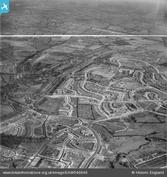
EAW046849 ENGLAND (1952). The residential area at Shard End under construction, Birmingham, from the west, 1952. This image was marked by Aerofilms Ltd for photo editing.
© Copyright OpenStreetMap contributors and licensed by the OpenStreetMap Foundation. 2026. Cartography is licensed as CC BY-SA.
Nearby Images (5)
EAW046849

EAW046852

EAW046855

EAW046854

EAW046853

Details
| Title | [EAW046849] The residential area at Shard End under construction, Birmingham, from the west, 1952. This image was marked by Aerofilms Ltd for photo editing. |
| Reference | EAW046849 |
| Date | 18-September-1952 |
| Link | |
| Place name | BIRMINGHAM |
| Parish | |
| District | |
| Country | ENGLAND |
| Easting / Northing | 414824, 288909 |
| Longitude / Latitude | -1.7816156431638, 52.497517653829 |
| National Grid Reference | SP148889 |
Pins
Be the first to add a comment to this image!