
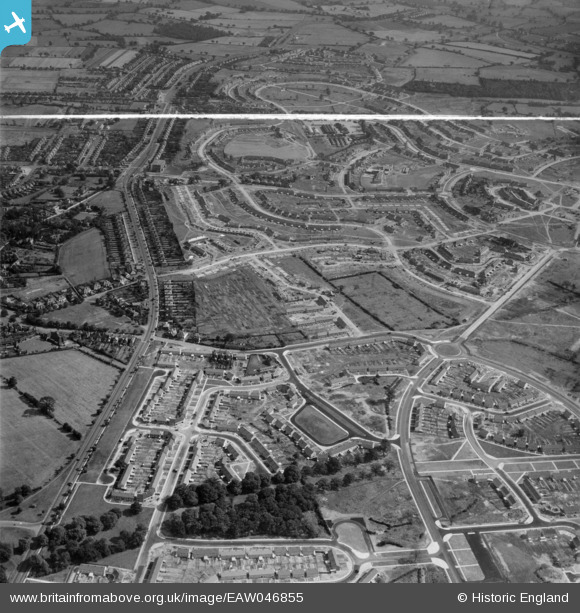
EAW046855 ENGLAND (1952). Bradford Road and the residential area at Shard End under construction, Birmingham, 1952. This image was marked by Aerofilms Ltd for photo editing.
© Copyright OpenStreetMap contributors and licensed by the OpenStreetMap Foundation. 2026. Cartography is licensed as CC BY-SA.
Nearby Images (4)
EAW046855

EAW046853

EAW046854

EAW046849

Details
| Title | [EAW046855] Bradford Road and the residential area at Shard End under construction, Birmingham, 1952. This image was marked by Aerofilms Ltd for photo editing. |
| Reference | EAW046855 |
| Date | 18-September-1952 |
| Link | |
| Place name | BIRMINGHAM |
| Parish | |
| District | |
| Country | ENGLAND |
| Easting / Northing | 414989, 289123 |
| Longitude / Latitude | -1.7791752745355, 52.499437198363 |
| National Grid Reference | SP150891 |
Pins

Rich |
Saturday 6th of June 2020 12:27:52 PM | |
|
Rich |
Saturday 6th of June 2020 12:27:22 PM | |
|
Tinkerbell |
Sunday 8th of June 2014 04:08:02 PM |