
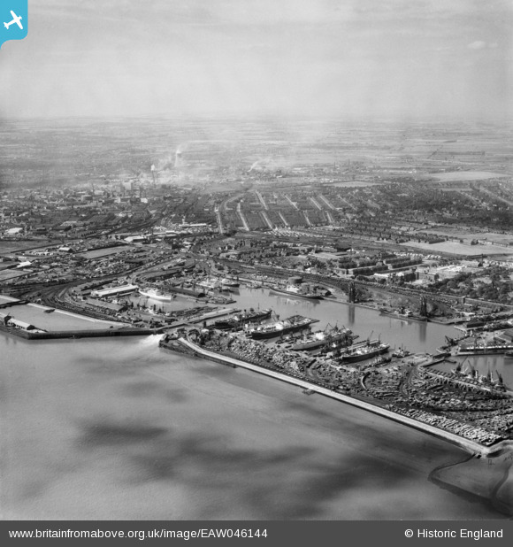
EAW046144 ENGLAND (1952). Alexandra Dock and the city, Kingston upon Hull, from the south-east, 1952
© Copyright OpenStreetMap contributors and licensed by the OpenStreetMap Foundation. 2026. Cartography is licensed as CC BY-SA.
Nearby Images (8)
EAW046144

EPW036422

EPW012698

EPW012699

EPW036546

EPW010817

EPW036559

EPW036379

Details
| Title | [EAW046144] Alexandra Dock and the city, Kingston upon Hull, from the south-east, 1952 |
| Reference | EAW046144 |
| Date | 22-August-1952 |
| Link | |
| Place name | KINGSTON UPON HULL |
| Parish | |
| District | |
| Country | ENGLAND |
| Easting / Northing | 512705, 428666 |
| Longitude / Latitude | -0.29092346975203, 53.741952715435 |
| National Grid Reference | TA127287 |
Pins

John Wass |
Saturday 30th of August 2014 08:11:49 PM |