
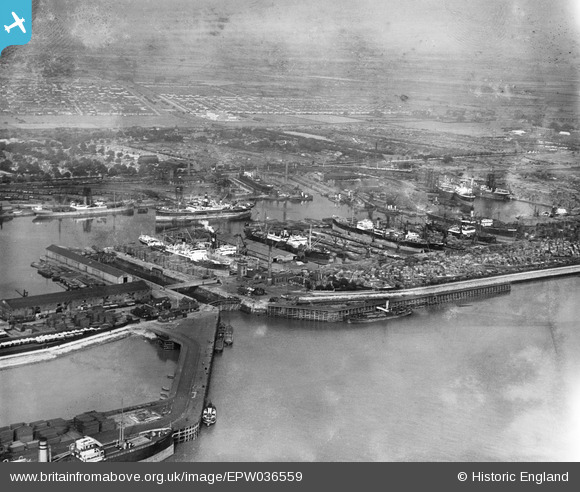
EPW036559 ENGLAND (1931). West Wharf, East Wharf and Alexandra Dock, Kingston upon Hull, 1931
© Copyright OpenStreetMap contributors and licensed by the OpenStreetMap Foundation. 2026. Cartography is licensed as CC BY-SA.
Nearby Images (7)
EPW036559

EPW036546

EPW036422

EPW012698

EPW012699

EAW046144

EAW015662

Details
| Title | [EPW036559] West Wharf, East Wharf and Alexandra Dock, Kingston upon Hull, 1931 |
| Reference | EPW036559 |
| Date | August-1931 |
| Link | |
| Place name | KINGSTON UPON HULL |
| Parish | |
| District | |
| Country | ENGLAND |
| Easting / Northing | 512600, 428868 |
| Longitude / Latitude | -0.29244132845409, 53.743790394452 |
| National Grid Reference | TA126289 |
Pins
Be the first to add a comment to this image!