
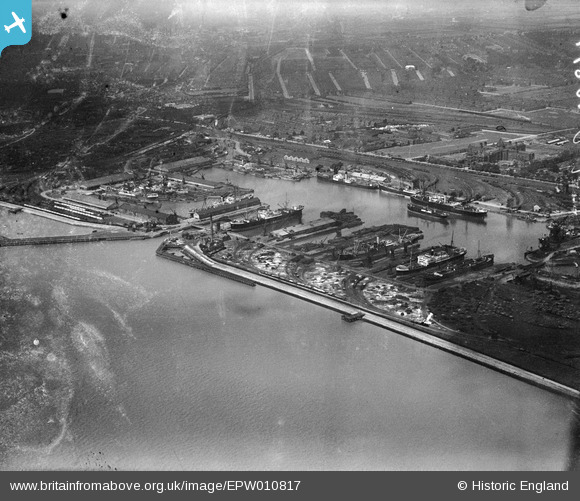
EPW010817 ENGLAND (1924). Alexandra Dock, Kingston upon Hull, from the south-east, 1924
© Copyright OpenStreetMap contributors and licensed by the OpenStreetMap Foundation. 2026. Cartography is licensed as CC BY-SA.
Nearby Images (3)
EPW010817

EAW046144

EPW036379

Details
| Title | [EPW010817] Alexandra Dock, Kingston upon Hull, from the south-east, 1924 |
| Reference | EPW010817 |
| Date | June-1924 |
| Link | |
| Place name | KINGSTON UPON HULL |
| Parish | |
| District | |
| Country | ENGLAND |
| Easting / Northing | 512709, 428463 |
| Longitude / Latitude | -0.29093686996536, 53.74012787611 |
| National Grid Reference | TA127285 |
Pins
Be the first to add a comment to this image!