
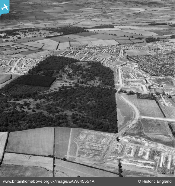
EAW045554A ENGLAND (1952). Hazel Wood and Thoroughsale Wood, Corby, from the south, 1952
© Copyright OpenStreetMap contributors and licensed by the OpenStreetMap Foundation. 2026. Cartography is licensed as CC BY-SA.
Nearby Images (3)
EAW045554A

EAW045555

EAW051442

Details
| Title | [EAW045554A] Hazel Wood and Thoroughsale Wood, Corby, from the south, 1952 |
| Reference | EAW045554A |
| Date | 19-July-1952 |
| Link | |
| Place name | CORBY |
| Parish | |
| District | |
| Country | ENGLAND |
| Easting / Northing | 487900, 288384 |
| Longitude / Latitude | -0.70538702388717, 52.48591616274 |
| National Grid Reference | SP879884 |
Pins

Michael Mahon |
Monday 12th of October 2015 06:17:08 PM |