
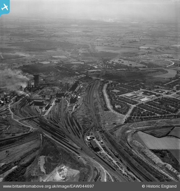
EAW044697 ENGLAND (1952). Stephenson Way, Lloyds Sidings and the Corby Steelworks, Corby, from the north, 1952
© Copyright OpenStreetMap contributors and licensed by the OpenStreetMap Foundation. 2025. Cartography is licensed as CC BY-SA.
Nearby Images (3)
EAW044697

EAW045472
 and the surrounding area, Corby, from the south-east, 1952")
EAW045471

Details
| Title | [EAW044697] Stephenson Way, Lloyds Sidings and the Corby Steelworks, Corby, from the north, 1952 |
| Reference | EAW044697 |
| Date | 22-July-1952 |
| Link | |
| Place name | CORBY |
| Parish | |
| District | |
| Country | ENGLAND |
| Easting / Northing | 489709, 290193 |
| Longitude / Latitude | -0.67826372560905, 52.50188204834 |
| National Grid Reference | SP897902 |
Pins

Dougie |
Friday 10th of April 2020 05:03:50 PM |