
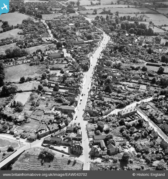
EAW043702 ENGLAND (1952). The High Street and town, Billericay, 1952
© Copyright OpenStreetMap contributors and licensed by the OpenStreetMap Foundation. 2026. Cartography is licensed as CC BY-SA.
Nearby Images (5)
EAW043702

EPW022338

EAW043701

EAW043700

EAW043699

Details
| Title | [EAW043702] The High Street and town, Billericay, 1952 |
| Reference | EAW043702 |
| Date | 4-June-1952 |
| Link | |
| Place name | BILLERICAY |
| Parish | BILLERICAY |
| District | |
| Country | ENGLAND |
| Easting / Northing | 567495, 194706 |
| Longitude / Latitude | 0.42009059323431, 51.625736842594 |
| National Grid Reference | TQ675947 |
Pins

Matt Aldred edob.mattaldred.com |
Tuesday 5th of December 2023 02:12:48 PM | |
|
Matt Aldred edob.mattaldred.com |
Tuesday 5th of December 2023 02:11:39 PM | |

SpongeLab |
Sunday 26th of September 2021 02:07:46 PM | |

Class31 |
Friday 27th of February 2015 10:49:12 PM |