
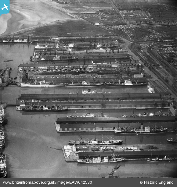
EAW042530 ENGLAND (1952). Alexandra Docks, Hornby Dock and Gladstone Docks, Bootle, 1952
© Copyright OpenStreetMap contributors and licensed by the OpenStreetMap Foundation. 2026. Cartography is licensed as CC BY-SA.
Nearby Images (4)
EAW042530

EAW042531

EPW050115

EAW042529

Details
| Title | [EAW042530] Alexandra Docks, Hornby Dock and Gladstone Docks, Bootle, 1952 |
| Reference | EAW042530 |
| Date | 18-May-1952 |
| Link | |
| Place name | BOOTLE |
| Parish | |
| District | |
| Country | ENGLAND |
| Easting / Northing | 332869, 395400 |
| Longitude / Latitude | -3.0109809699175, 53.45082295409 |
| National Grid Reference | SJ329954 |
Pins

Davemat |
Friday 31st of March 2017 03:42:54 PM |