
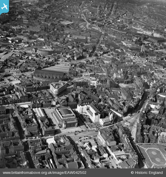
EAW042502 ENGLAND (1952). The city centre, Sheffield, 1952
© Copyright OpenStreetMap contributors and licensed by the OpenStreetMap Foundation. 2026. Cartography is licensed as CC BY-SA.
Nearby Images (20)
EAW042502

EPW055233

EAW031288

EAW031289

EAW042500

EPW055246

EPW055242

EAW031290

EAW042501

EAW037096

EPW061497

EPW055231

EAW037094

EPW015460

EPW021135

EPW015596

EPW015461

EPW047989

EAW031291

EPW015466

Details
| Title | [EAW042502] The city centre, Sheffield, 1952 |
| Reference | EAW042502 |
| Date | 17-April-1952 |
| Link | |
| Place name | SHEFFIELD |
| Parish | |
| District | |
| Country | ENGLAND |
| Easting / Northing | 435257, 387426 |
| Longitude / Latitude | -1.4698951971764, 53.3822405001 |
| National Grid Reference | SK353874 |
Pins
Be the first to add a comment to this image!