
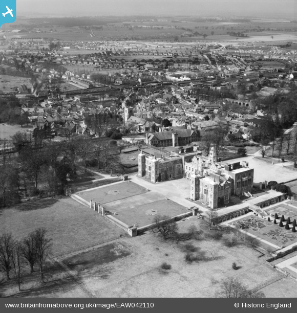
EAW042110 ENGLAND (1952). Hatfield House and the town, Hatfield, from the south-east, 1952
© Copyright OpenStreetMap contributors and licensed by the OpenStreetMap Foundation. 2026. Cartography is licensed as CC BY-SA.
Nearby Images (35)
EAW042110

EAW014162

EAW014160

EAW042111

EAW053188

EAW050562

EAW049360

EPW022351

EAW053192

EAW014164

EPW025381

EAW042106

EAW014165

EAW014161

EAW049356

EAW049358

EAW049359

EAW014167

EAW036788

EAW042107

EAW014166

EAW053002

EAW050563

EAW014163

EAW042109

EAW042108

EAW050561

EAW049355

EAW053190

EAW053191

EAW049361

EAW053189

EAW049357

EAW049354

EPW025380

Details
| Title | [EAW042110] Hatfield House and the town, Hatfield, from the south-east, 1952 |
| Reference | EAW042110 |
| Date | 27-March-1952 |
| Link | |
| Place name | HATFIELD |
| Parish | HATFIELD |
| District | |
| Country | ENGLAND |
| Easting / Northing | 523727, 208304 |
| Longitude / Latitude | -0.20708640564817, 51.759282582383 |
| National Grid Reference | TL237083 |
Pins


User Comment Contributions

South front Hatfield House, Hatfield 24/05/2014 |

Class31 |
Tuesday 27th of May 2014 11:00:47 AM |

Looking north west from the west garden Hatfield House, Hatfield 24/05/2014 |
Class31 |
Tuesday 27th of May 2014 10:59:40 AM |
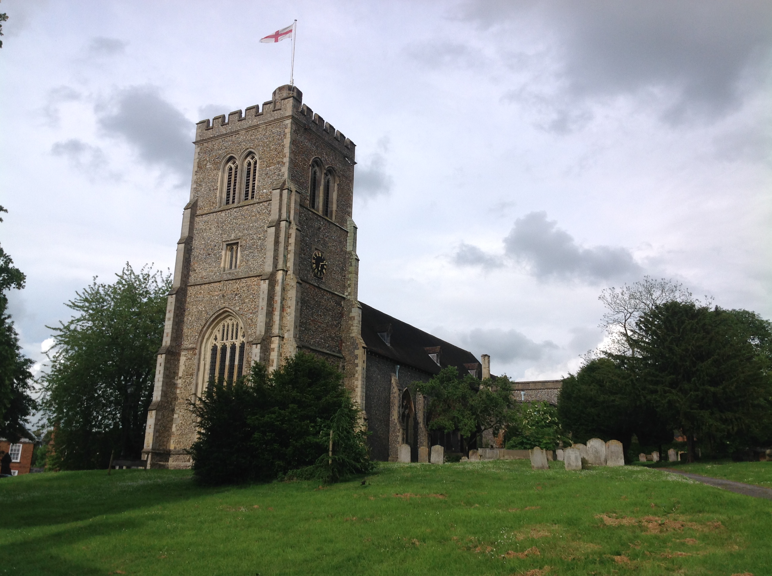
St. Etheldreda's Church, Old Hatfield 24/05/2014 |
Class31 |
Tuesday 27th of May 2014 10:00:44 AM |