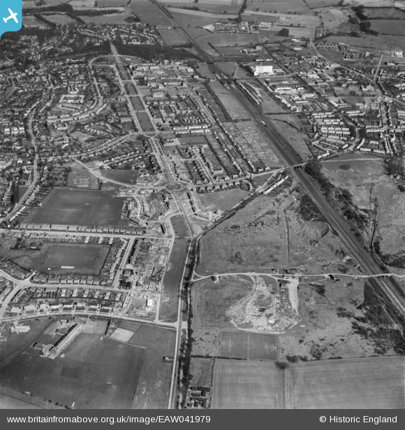
EAW041979 ENGLAND (1952). Parkway and construction work around Colgrove, Handside, 1952
    © Copyright OpenStreetMap contributors and licensed by the OpenStreetMap Foundation. 2025. Cartography is licensed as CC BY-SA.
  
Details
| Title | [EAW041979] Parkway and construction work around Colgrove, Handside, 1952 | 
| Reference | EAW041979 | 
| Date | 14-March-1952 | 
| Link | |
| Place name | HANDSIDE | 
| Parish | |
| District | |
| Country | ENGLAND | 
| Easting / Northing | 523367, 212004 | 
| Longitude / Latitude | -0.21098545340956, 51.79261650266 | 
| National Grid Reference | TL234120 | 
Pins
Be the first to add a comment to this image!
 
             
  ![[EAW041979] Parkway and construction work around Colgrove, Handside, 1952](http://britainfromabove.org.uk/sites/all/libraries/aerofilms-images/public/100x100/EAW/041/EAW041979.jpg) 
  
                                          ![[EPW062069] Handside, Welwyn Garden City, from the south-east, 1939](http://britainfromabove.org.uk/sites/all/libraries/aerofilms-images/public/100x100/EPW/062/EPW062069.jpg) 
 ![[EPW047375] Handside and Sherrardspark Wood, Welwyn Garden City, from the south-west, 1935](http://britainfromabove.org.uk/sites/all/libraries/aerofilms-images/public/100x100/EPW/047/EPW047375.jpg) 
 ![[EPW054495] Twentieth Mile Bridge and the surrounding residential area, Handside, 1937](http://britainfromabove.org.uk/sites/all/libraries/aerofilms-images/public/100x100/EPW/054/EPW054495.jpg)