
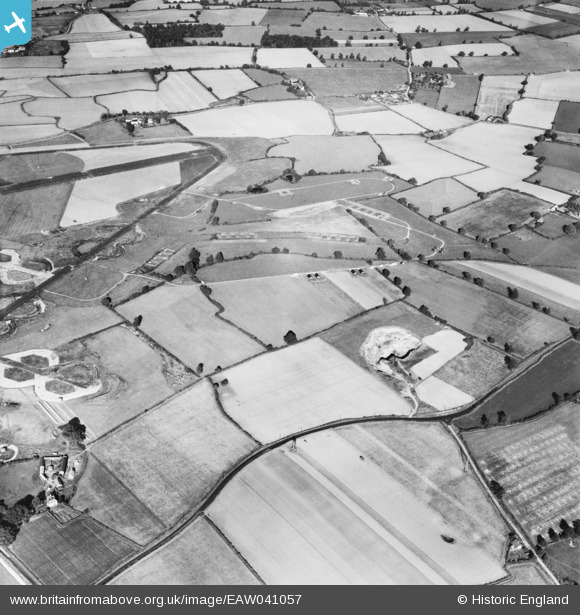
EAW041057 ENGLAND (1951). Birch Gravel Pit by Roundbush Corner and Birch Airfield, Birch, 1951
© Copyright OpenStreetMap contributors and licensed by the OpenStreetMap Foundation. 2026. Cartography is licensed as CC BY-SA.
Nearby Images (16)
EAW041057

EAW041056

EAW040906
 alongside Birch Airfield, Birch, 1951. This image was marked by Aerofilms Ltd for photo editing.")
EAW041054

EAW041053

EAW041055

EAW040907
 alongside Birch Airfield, Birch, 1951. This image was marked by Aerofilms Ltd for photo editing.")
EAW040910
 alongside Birch Airfield, Birch, 1951. This image was marked by Aerofilms Ltd for photo editing.")
EAW040912
 alongside Birch Airfield, Birch, 1951. This image was marked by Aerofilms Ltd for photo editing.")
EAW040913
 alongside Birch Airfield, Birch, 1951. This image was marked by Aerofilms Ltd for photo editing.")
EAW040914
 alongside Birch Airfield, Birch, 1951. This image was marked by Aerofilms Ltd for photo editing.")
EAW040908
 alongside Birch Airfield, Birch, 1951. This image was marked by Aerofilms Ltd for photo editing.")
EAW040909
 alongside Birch Airfield, Birch, 1951. This image was marked by Aerofilms Ltd for photo editing.")
EAW040903
, Birch, 1951. This image was marked by Aerofilms Ltd for photo editing.")
EAW040904
, Birch, 1951. This image was marked by Aerofilms Ltd for photo editing.")
EAW040905
, Birch, 1951. This image was marked by Aerofilms Ltd for photo editing.")
Details
| Title | [EAW041057] Birch Gravel Pit by Roundbush Corner and Birch Airfield, Birch, 1951 |
| Reference | EAW041057 |
| Date | 23-October-1951 |
| Link | |
| Place name | BIRCH |
| Parish | BIRCH |
| District | |
| Country | ENGLAND |
| Easting / Northing | 592656, 219555 |
| Longitude / Latitude | 0.79695471383005, 51.840866676824 |
| National Grid Reference | TL927196 |
