
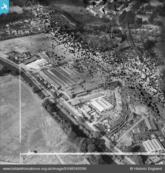
EAW040096 ENGLAND (1951). The Imperial Foundry and Grand Union Canal, Royal Leamington Spa, 1951. This image has been produced from a damaged negative.
© Copyright OpenStreetMap contributors and licensed by the OpenStreetMap Foundation. 2026. Cartography is licensed as CC BY-SA.
Nearby Images (19)
EAW040096

EAW000232

EAW000236

EPW053199

EPW053200

EPW053197

EPW053196

EPW053195

EAW000233

EAW000238

EAW000149
 Foundry off Prince's Drive, Royal Leamington Spa, 1946")
EAW040094

EPW053198

EAW000237

EAW000235

EAW000150
 Foundry off Prince's Drive, Royal Leamington Spa, 1946")
EAW040095

EAW000234

EPW001216

Details
| Title | [EAW040096] The Imperial Foundry and Grand Union Canal, Royal Leamington Spa, 1951. This image has been produced from a damaged negative. |
| Reference | EAW040096 |
| Date | 26-September-1951 |
| Link | |
| Place name | ROYAL LEAMINGTON SPA |
| Parish | ROYAL LEAMINGTON SPA |
| District | |
| Country | ENGLAND |
| Easting / Northing | 431093, 265186 |
| Longitude / Latitude | -1.54415257601, 52.283542523273 |
| National Grid Reference | SP311652 |
Pins
Be the first to add a comment to this image!