
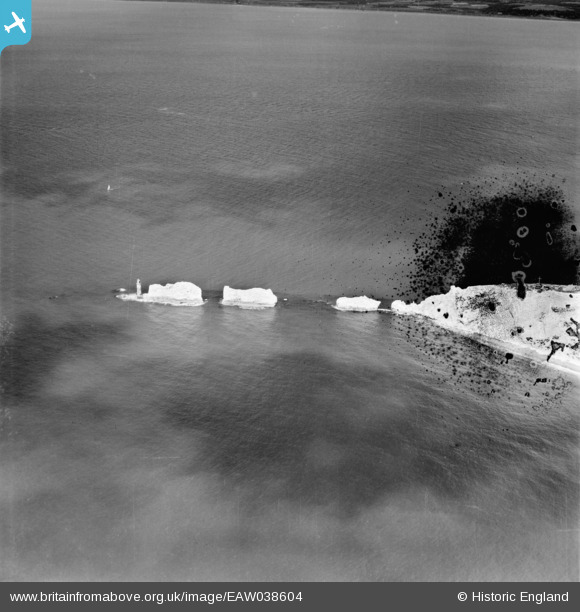
EAW038604 ENGLAND (1951). The Needles, Isle of Wight, 1951. This image has been produced from a damaged negative.
© Copyright OpenStreetMap contributors and licensed by the OpenStreetMap Foundation. 2026. Cartography is licensed as CC BY-SA.
Nearby Images (21)
EAW038604

EAW038608

EAW015258

EAW002997

EAW015259

EAW038605

EPW022899

EPW022903

EAW038607

EPW000795

EPW022902

EAW038606

EPW000793

EPW022901

EAW022203

EAW022202

EAW022204

EPW000479

EAW015260

EAW022201

EPW000478

Details
| Title | [EAW038604] The Needles, Isle of Wight, 1951. This image has been produced from a damaged negative. |
| Reference | EAW038604 |
| Date | 13-August-1951 |
| Link | |
| Place name | ISLE OF WIGHT |
| Parish | TOTLAND |
| District | |
| Country | ENGLAND |
| Easting / Northing | 429152, 84908 |
| Longitude / Latitude | -1.5874940155648, 50.662533623426 |
| National Grid Reference | SZ292849 |
Pins
Be the first to add a comment to this image!