
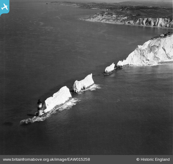
EAW015258 ENGLAND (1948). The Needles, Isle of Wight, 1948
© Copyright OpenStreetMap contributors and licensed by the OpenStreetMap Foundation. 2026. Cartography is licensed as CC BY-SA.
Nearby Images (21)
EAW015258

EAW038604

EAW015259

EAW038608

EAW038605

EPW022903

EAW002997

EPW022899

EAW038606

EPW000793

EPW022902

EPW022901

EAW022203

EPW000795

EAW038607

EAW022202

EAW022204

EPW000479

EAW015260

EAW022201

EPW000478

Details
| Title | [EAW015258] The Needles, Isle of Wight, 1948 |
| Reference | EAW015258 |
| Date | 6-May-1948 |
| Link | |
| Place name | ISLE OF WIGHT |
| Parish | TOTLAND |
| District | |
| Country | ENGLAND |
| Easting / Northing | 429137, 84861 |
| Longitude / Latitude | -1.58770996366, 50.662111676871 |
| National Grid Reference | SZ291849 |
