
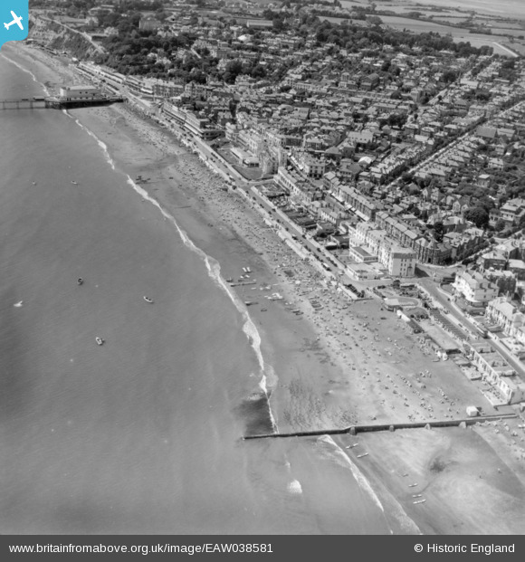
EAW038581 ENGLAND (1951). The town and seafront, Sandown, 1951. This image has been produced from a print.
© Copyright OpenStreetMap contributors and licensed by the OpenStreetMap Foundation. 2026. Cartography is licensed as CC BY-SA.
Nearby Images (6)
EAW038581

EAW022218

EPW023082

EPW043025

EPW043026

EPW039670

Details
| Title | [EAW038581] The town and seafront, Sandown, 1951. This image has been produced from a print. |
| Reference | EAW038581 |
| Date | 13-August-1951 |
| Link | |
| Place name | SANDOWN |
| Parish | SANDOWN |
| District | |
| Country | ENGLAND |
| Easting / Northing | 460205, 84269 |
| Longitude / Latitude | -1.1482309165492, 50.654403930495 |
| National Grid Reference | SZ602843 |
Pins

Bluid |
Wednesday 15th of June 2016 02:27:26 PM |