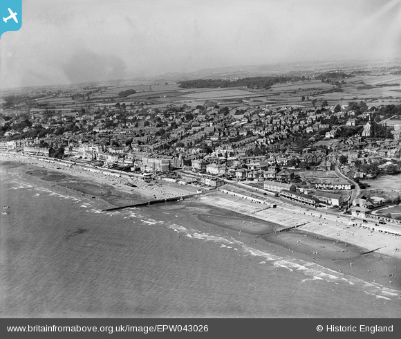
EPW043026 ENGLAND (1933). The seafront and town, Sandown, from the south-east, 1933
© Copyright OpenStreetMap contributors and licensed by the OpenStreetMap Foundation. 2026. Cartography is licensed as CC BY-SA.
Details
| Title | [EPW043026] The seafront and town, Sandown, from the south-east, 1933 |
| Reference | EPW043026 |
| Date | August-1933 |
| Link | |
| Place name | SANDOWN |
| Parish | SANDOWN |
| District | |
| Country | ENGLAND |
| Easting / Northing | 460410, 84328 |
| Longitude / Latitude | -1.1453213294953, 50.654913274355 |
| National Grid Reference | SZ604843 |
Pins
Be the first to add a comment to this image!


![[EPW043026] The seafront and town, Sandown, from the south-east, 1933](http://britainfromabove.org.uk/sites/all/libraries/aerofilms-images/public/100x100/EPW/043/EPW043026.jpg)
![[EPW043024] The seafront and town, Sandown, from the south-east, 1933](http://britainfromabove.org.uk/sites/all/libraries/aerofilms-images/public/100x100/EPW/043/EPW043024.jpg)
![[EAW038581] The town and seafront, Sandown, 1951. This image has been produced from a print.](http://britainfromabove.org.uk/sites/all/libraries/aerofilms-images/public/100x100/EAW/038/EAW038581.jpg)
![[EPW023082] The junction of Victoria Road, High Street and Avenue Slipway, Sandown, 1928](http://britainfromabove.org.uk/sites/all/libraries/aerofilms-images/public/100x100/EPW/023/EPW023082.jpg)