
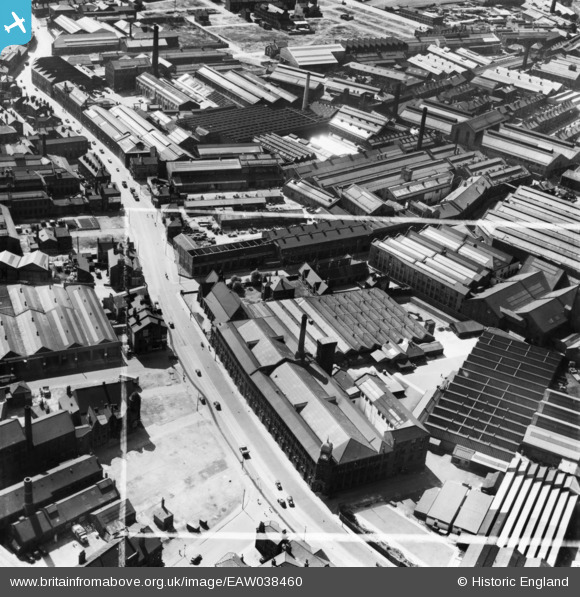
EAW038460 ENGLAND (1951). The Alf Cooke Ltd Crown Point Printing Works on Hunslet Road and environs, Hunslet, 1951. This image has been produced from a print marked by Aerofilms Ltd for photo editing.
© Copyright OpenStreetMap contributors and licensed by the OpenStreetMap Foundation. 2026. Cartography is licensed as CC BY-SA.
Nearby Images (21)
EAW038460

EPW034097

EAW038461

EPW034099

EPW031642

EPW031643

EPW034095

EPW031644

EAW038455

EAW015962

EAW038458

EPW034096

EAW038452

EAW038459

EAW015960

EAW015961

EPW034098

EAW015963

EAW015965

EAW015966

EAW015964

Details
| Title | [EAW038460] The Alf Cooke Ltd Crown Point Printing Works on Hunslet Road and environs, Hunslet, 1951. This image has been produced from a print marked by Aerofilms Ltd for photo editing. |
| Reference | EAW038460 |
| Date | 2-August-1951 |
| Link | |
| Place name | HUNSLET |
| Parish | |
| District | |
| Country | ENGLAND |
| Easting / Northing | 430654, 432511 |
| Longitude / Latitude | -1.5346703797609, 53.787798568597 |
| National Grid Reference | SE307325 |
