
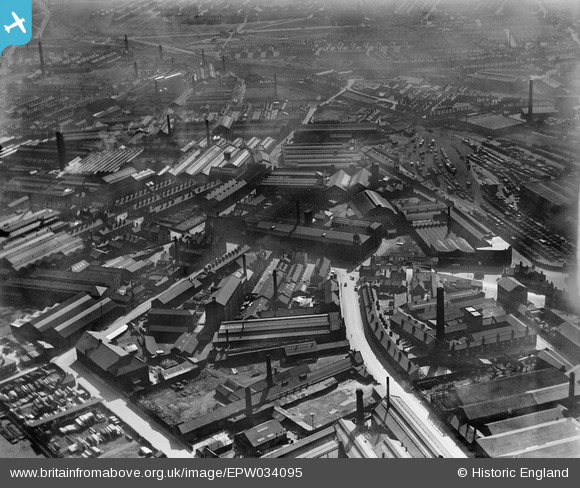
EPW034095 ENGLAND (1930). The Crown Point Printing Works, Globs Mills and the Yorkshire Steel Foundry, Pottery Field, 1930
© Copyright OpenStreetMap contributors and licensed by the OpenStreetMap Foundation. 2026. Cartography is licensed as CC BY-SA.
Nearby Images (20)
EPW034095

EPW031644

EPW031643

EPW031642

EAW038461

EPW034097

EAW038458

EPW034096

EPW034099

EAW038459

EPW034098

EAW038460

EAW038455

EAW015962

EAW038452

EAW015960

EAW015961

EAW015963

EAW015965

EAW015966

Details
| Title | [EPW034095] The Crown Point Printing Works, Globs Mills and the Yorkshire Steel Foundry, Pottery Field, 1930 |
| Reference | EPW034095 |
| Date | July-1930 |
| Link | |
| Place name | POTTERY FIELD |
| Parish | |
| District | |
| Country | ENGLAND |
| Easting / Northing | 430635, 432589 |
| Longitude / Latitude | -1.5349510364981, 53.788500808447 |
| National Grid Reference | SE306326 |
Pins

sirdouglas |
Thursday 10th of April 2014 12:02:34 PM | |
|
sirdouglas |
Thursday 10th of April 2014 12:00:22 PM | |
|
sirdouglas |
Thursday 10th of April 2014 11:56:40 AM | |
|
sirdouglas |
Thursday 10th of April 2014 11:54:47 AM | |
|
sirdouglas |
Thursday 10th of April 2014 11:50:51 AM | |
|
sirdouglas |
Thursday 10th of April 2014 11:43:18 AM | |
|
sirdouglas |
Thursday 10th of April 2014 11:39:00 AM |