
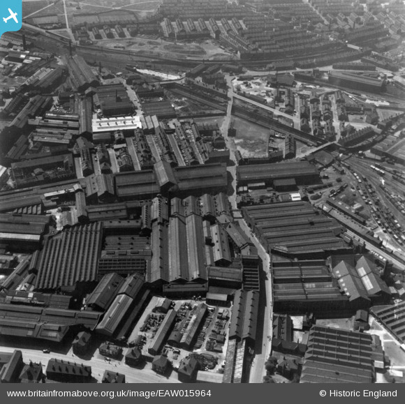
EAW015964 ENGLAND (1948). Industrial area at Pottery Field, Hunslet, 1948. This image has been produced from a print.
© Copyright OpenStreetMap contributors and licensed by the OpenStreetMap Foundation. 2026. Cartography is licensed as CC BY-SA.
Nearby Images (21)
EAW015964

EAW015965

EAW015963

EAW015966

EAW015960

EAW015961

EAW031356

EAW031361

EAW031353

EAW031359

EAW031360

EAW031357

EAW038452

EAW015962

EAW031354

EAW031358

EAW038455

EAW038460

EAW031355

EPW034099

EPW034097

Details
| Title | [EAW015964] Industrial area at Pottery Field, Hunslet, 1948. This image has been produced from a print. |
| Reference | EAW015964 |
| Date | 19-May-1948 |
| Link | |
| Place name | HUNSLET |
| Parish | |
| District | |
| Country | ENGLAND |
| Easting / Northing | 430572, 432316 |
| Longitude / Latitude | -1.5359344434666, 53.786050588863 |
| National Grid Reference | SE306323 |
