
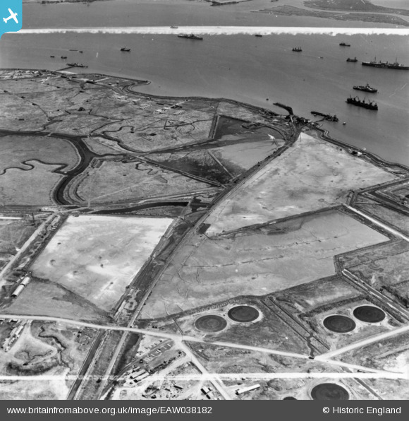
EAW038182 ENGLAND (1951). Stan Marsh, Horseshoe Point and environs, Isle of Grain, 1951. This image has been produced from a print marked by Aerofilms Ltd for photo editing.
© Copyright OpenStreetMap contributors and licensed by the OpenStreetMap Foundation. 2026. Cartography is licensed as CC BY-SA.
Nearby Images (3)
EAW038182

EAW038184

EAW038207

Details
| Title | [EAW038182] Stan Marsh, Horseshoe Point and environs, Isle of Grain, 1951. This image has been produced from a print marked by Aerofilms Ltd for photo editing. |
| Reference | EAW038182 |
| Date | 2-August-1951 |
| Link | |
| Place name | ISLE OF GRAIN |
| Parish | ISLE OF GRAIN |
| District | |
| Country | ENGLAND |
| Easting / Northing | 587426, 174441 |
| Longitude / Latitude | 0.69695603018678, 51.437422210163 |
| National Grid Reference | TQ874744 |
Pins

redmist |
Sunday 23rd of January 2022 10:47:09 PM | |
|
redmist |
Sunday 23rd of January 2022 10:45:43 PM | |
|
redmist |
Sunday 23rd of January 2022 10:42:57 PM | |
|
redmist |
Sunday 23rd of January 2022 10:41:54 PM | |
|
redmist |
Sunday 23rd of January 2022 10:40:53 PM | |
|
redmist |
Sunday 23rd of January 2022 10:16:01 PM |