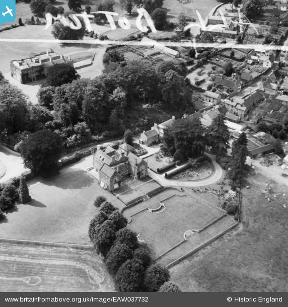
EAW037732 ENGLAND (1951). Guilsborough House and Hall, Guilsborough, 1951. This image was marked by Aerofilms Ltd for photo editing.
© Copyright OpenStreetMap contributors and licensed by the OpenStreetMap Foundation. 2025. Cartography is licensed as CC BY-SA.
Nearby Images (7)
Details
| Title | [EAW037732] Guilsborough House and Hall, Guilsborough, 1951. This image was marked by Aerofilms Ltd for photo editing. |
| Reference | EAW037732 |
| Date | 17-July-1951 |
| Link | |
| Place name | GUILSBOROUGH |
| Parish | GUILSBOROUGH |
| District | |
| Country | ENGLAND |
| Easting / Northing | 467711, 272772 |
| Longitude / Latitude | -1.0058411540459, 52.348447942315 |
| National Grid Reference | SP677728 |
Pins
Be the first to add a comment to this image!


![[EAW037732] Guilsborough House and Hall, Guilsborough, 1951. This image was marked by Aerofilms Ltd for photo editing.](http://britainfromabove.org.uk/sites/all/libraries/aerofilms-images/public/100x100/EAW/037/EAW037732.jpg)
![[EAW037734] Guilsborough House and Hall, Guilsborough, 1951. This image was marked by Aerofilms Ltd for photo editing.](http://britainfromabove.org.uk/sites/all/libraries/aerofilms-images/public/100x100/EAW/037/EAW037734.jpg)
![[EAW037736] Guilsborough House and the High Street, Guilsborough, 1951. This image was marked by Aerofilms Ltd for photo editing.](http://britainfromabove.org.uk/sites/all/libraries/aerofilms-images/public/100x100/EAW/037/EAW037736.jpg)
![[EAW037733] Guilsborough House, Guilsborough, 1951. This image was marked by Aerofilms Ltd for photo editing.](http://britainfromabove.org.uk/sites/all/libraries/aerofilms-images/public/100x100/EAW/037/EAW037733.jpg)
![[EAW037735] Guilsborough House and the surrounding countryside, Guilsborough, 1951. This image was marked by Aerofilms Ltd for photo editing.](http://britainfromabove.org.uk/sites/all/libraries/aerofilms-images/public/100x100/EAW/037/EAW037735.jpg)
![[EAW037731] The village and the surrounding countryside, Guilsborough, 1951. This image was marked by Aerofilms Ltd for photo editing.](http://britainfromabove.org.uk/sites/all/libraries/aerofilms-images/public/100x100/EAW/037/EAW037731.jpg)
![[EAW037737] Baling hay nearby the village, Guilsborough, 1951](http://britainfromabove.org.uk/sites/all/libraries/aerofilms-images/public/100x100/EAW/037/EAW037737.jpg)