
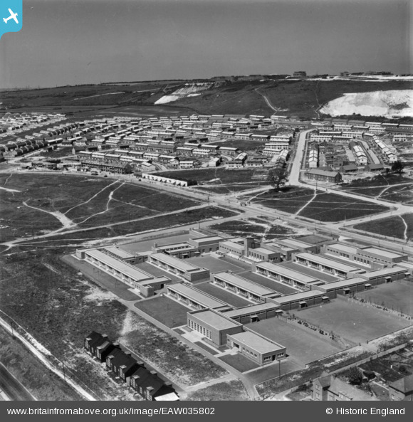
EAW035802 ENGLAND (1951). Hillside Primary Schools and environs, Paulsgrove, from the south-east, 1951. This image has been produced from a print.
© Copyright OpenStreetMap contributors and licensed by the OpenStreetMap Foundation. 2026. Cartography is licensed as CC BY-SA.
Nearby Images (5)
EAW035802

EAW035801

EAW035796

EAW035800

EAW035797

Details
| Title | [EAW035802] Hillside Primary Schools and environs, Paulsgrove, from the south-east, 1951. This image has been produced from a print. |
| Reference | EAW035802 |
| Date | 12-May-1951 |
| Link | |
| Place name | PAULSGROVE |
| Parish | |
| District | |
| Country | ENGLAND |
| Easting / Northing | 464038, 105847 |
| Longitude / Latitude | -1.0902558349179, 50.848035843231 |
| National Grid Reference | SU640058 |
Pins
Be the first to add a comment to this image!