
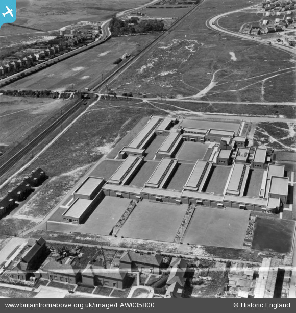
EAW035800 ENGLAND (1951). Hillside Primary Schools, Paulsgrove, 1951. This image has been produced from a print marked by Aerofilms Ltd for photo editing.
© Copyright OpenStreetMap contributors and licensed by the OpenStreetMap Foundation. 2026. Cartography is licensed as CC BY-SA.
Nearby Images (5)
EAW035800

EAW035796

EAW035802

EAW035801

EAW035797

Details
| Title | [EAW035800] Hillside Primary Schools, Paulsgrove, 1951. This image has been produced from a print marked by Aerofilms Ltd for photo editing. |
| Reference | EAW035800 |
| Date | 12-May-1951 |
| Link | |
| Place name | PAULSGROVE |
| Parish | |
| District | |
| Country | ENGLAND |
| Easting / Northing | 463995, 105849 |
| Longitude / Latitude | -1.0908662748031, 50.848058587886 |
| National Grid Reference | SU640058 |
Pins

Matt Aldred edob.mattaldred.com |
Friday 23rd of May 2025 04:56:11 PM | |

CHANCES-R |
Wednesday 18th of November 2020 04:46:21 PM | |
|
John Wass |
Tuesday 1st of November 2016 03:26:32 PM | |
Was this line electric then? I can remember diesels along here well into 70s?? |
Jeff@Clanfield |
Monday 8th of April 2019 07:19:49 PM |
There's no sign of a 3rd rail so the line can't yet have been electrified. |
Brightonboy |
Monday 8th of April 2019 10:36:15 PM |