
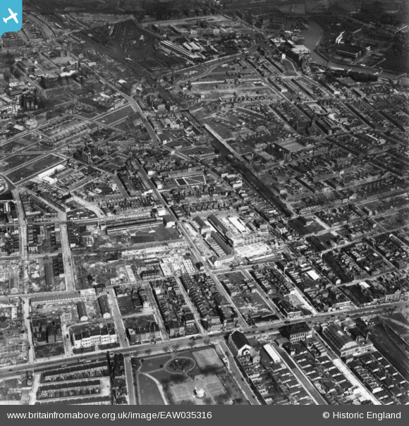
EAW035316 ENGLAND (1951). Kerbey Street and environs, Poplar, 1951. This image has been produced from a print.
© Copyright OpenStreetMap contributors and licensed by the OpenStreetMap Foundation. 2026. Cartography is licensed as CC BY-SA.
Nearby Images (6)
EAW035316

EAW035317

EAW035319

EAW035318

EAW035320

EAW000644

Details
| Title | [EAW035316] Kerbey Street and environs, Poplar, 1951. This image has been produced from a print. |
| Reference | EAW035316 |
| Date | 10-April-1951 |
| Link | |
| Place name | POPLAR |
| Parish | |
| District | |
| Country | ENGLAND |
| Easting / Northing | 537815, 181306 |
| Longitude / Latitude | -0.013696594616911, 51.513365285498 |
| National Grid Reference | TQ378813 |
Pins

Robin |
Saturday 29th of June 2019 04:34:28 PM | |
|
Robin |
Saturday 29th of June 2019 03:52:51 PM | |
|
Robin |
Saturday 29th of June 2019 03:41:55 PM | |
|
Robin |
Saturday 29th of June 2019 03:41:10 PM | |
|
Robin |
Saturday 29th of June 2019 03:36:56 PM | |
|
Robin |
Saturday 29th of June 2019 03:26:35 PM | |
|
Robin |
Saturday 29th of June 2019 03:03:39 PM |