
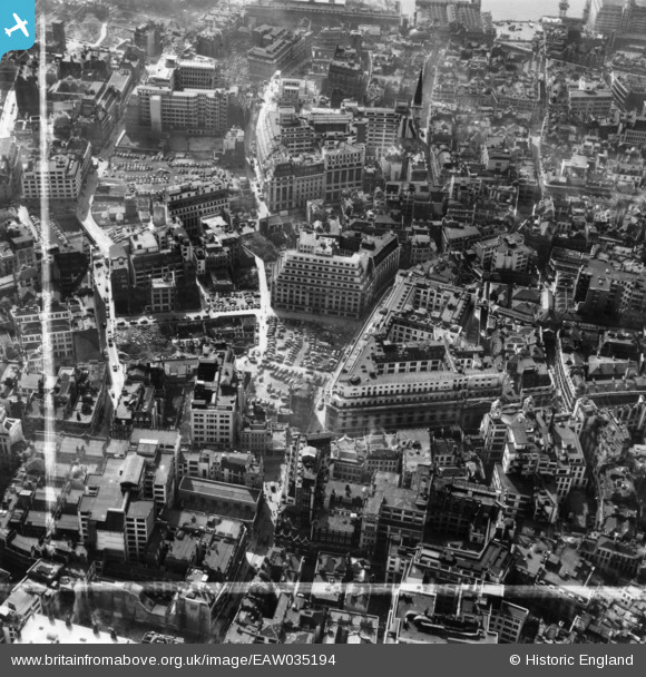
EAW035194 ENGLAND (1951). The Lloyd's Building, Lime Street and environs, London, 1951. This image has been produced from a print marked by Aerofilms Ltd for photo editing.
© Copyright OpenStreetMap contributors and licensed by the OpenStreetMap Foundation. 2026. Cartography is licensed as CC BY-SA.
Nearby Images (22)
EAW035194

EAW035193

EAW035196

EAW035190

EAW011173

EAW035195

EAW035197

EAW035192

EAW035191

EAW035189

EAW004896

EAW011133

EAW000510

EAW035188

EPW057040

EAW004897

EAW011134

EAW011174

EAW011132

EAW000631

EAW011375

EAW011172

Details
| Title | [EAW035194] The Lloyd's Building, Lime Street and environs, London, 1951. This image has been produced from a print marked by Aerofilms Ltd for photo editing. |
| Reference | EAW035194 |
| Date | 3-April-1951 |
| Link | |
| Place name | LONDON |
| Parish | |
| District | |
| Country | ENGLAND |
| Easting / Northing | 533194, 181047 |
| Longitude / Latitude | -0.080355220396895, 51.512146063517 |
| National Grid Reference | TQ332810 |
Pins

Class31 |
Friday 23rd of October 2015 10:46:40 PM |
