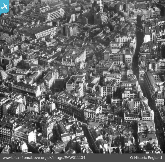
EAW011134 ENGLAND (1947). Leadenhall Street and Bishopsgate by St Helen's Church and environs, London, 1947. This image has been produced from a print.
© Copyright OpenStreetMap contributors and licensed by the OpenStreetMap Foundation. 2026. Cartography is licensed as CC BY-SA.
Nearby Images (21)
EAW011134

EAW004896

EAW035191

EAW035192

EAW011173

EAW035190

EAW035193

EAW004897

EAW035194

EAW011135

EAW035196

EAW035189

EAW011172

EAW011195
, Bury Street and environs, London, 1947")
EAW035195

EAW035197

EAW011194

EAW011133

EAW000510

EAW011174

EAW011375

Details
| Title | [EAW011134] Leadenhall Street and Bishopsgate by St Helen's Church and environs, London, 1947. This image has been produced from a print. |
| Reference | EAW011134 |
| Date | 30-September-1947 |
| Link | |
| Place name | LONDON |
| Parish | |
| District | |
| Country | ENGLAND |
| Easting / Northing | 533185, 181239 |
| Longitude / Latitude | -0.080412302171223, 51.513873773177 |
| National Grid Reference | TQ332812 |