
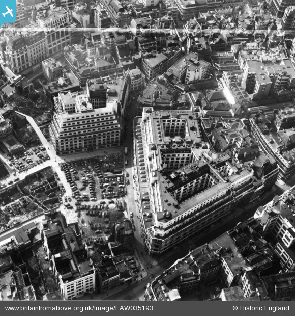
EAW035193 ENGLAND (1951). The Lloyd's Building and environs, London, 1951. This image has been produced from a print marked by Aerofilms Ltd for photo editing.
© Copyright OpenStreetMap contributors and licensed by the OpenStreetMap Foundation. 2026. Cartography is licensed as CC BY-SA.
Nearby Images (25)
EAW035193

EAW035190

EAW035196

EAW035194

EAW011173

EAW035192

EAW035195

EAW035197

EAW035191

EAW035189

EAW004896

EAW011133

EAW000510

EAW004897

EAW011174

EAW035188

EAW011134

EPW057040

EAW011132

EAW000631

EAW011375

EAW016644

EAW011172

EAW013047

EPW005764

Details
| Title | [EAW035193] The Lloyd's Building and environs, London, 1951. This image has been produced from a print marked by Aerofilms Ltd for photo editing. |
| Reference | EAW035193 |
| Date | 3-April-1951 |
| Link | |
| Place name | LONDON |
| Parish | |
| District | |
| Country | ENGLAND |
| Easting / Northing | 533169, 181061 |
| Longitude / Latitude | -0.080710023502715, 51.512277781707 |
| National Grid Reference | TQ332811 |
Pins
Be the first to add a comment to this image!